A Comparative Study on LEGO LOAM and SC-LEGO LOAM
Introduction
In a recent study, we compared the results of LEGO LOAM (Laser Optimized and Autonomous Mapping) and SC LEGO LOAM (Simultaneous Localization and Mapping with LEGO LOAM) by collecting data from NUANCE, Northeastern University's autonomous car. Our goal was to determine which method was more effective at creating high-quality 3D maps of complex environments.


Data Collection
To collect the data, we used NUANCE to navigate through a variety of environments, including urban areas and buildings. We equipped the car with laser rangefinders, cameras, and inertial measurement units (IMUs), which allowed it to scan its surroundings and collect data on the distances to nearby objects.

ICP Algorithm
After we collected the data, I used ICP (Iterative Closest Point) to generate 3D maps. ICP is an algorithm that is often used in the LEGO LOAM method for creating 3D maps of environments. The algorithm is used to align two point clouds, which are sets of points in 3D space that represent the shape of an environment.
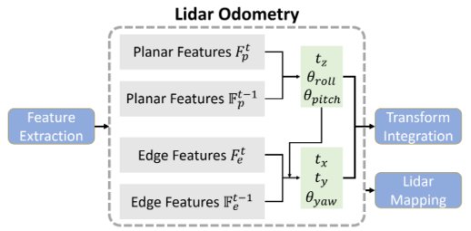
The ICP algorithm works by iteratively adjusting the position and orientation of one of the point clouds to minimize the distance between it and the other point cloud. This is done by identifying the closest point in the second point cloud to each point in the first point cloud and minimizing the sum of the squared distances between these points.
In LEGO LOAM, ICP is used to align the current point cloud, which is generated by the laser rangefinder, with the accumulated point cloud, which is a composite of all the previous scans of the environment. By aligning the current point cloud with the accumulated point cloud, ICP helps to improve the accuracy of the 3D map.
Results and Analysis
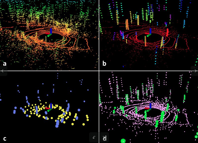
One of the reasons that SC LEGO LOAM was more effective is that it was able to take advantage of multiple small loop closures. Loop closures occur when the ego vehicle returns to a location it has previously visited, and they are used to improve the accuracy of the 3D map. By performing multiple small loop closures, we were able to significantly improve the quality of the 3D maps created using SC LEGO LOAM.
Conclusion
In conclusion, we found that SC LEGO LOAM was generally more effective at creating high-quality 3D maps of complex environments compared to LEGO LOAM. One of the reasons for this was the ability of SC LEGO LOAM to take advantage of multiple small loop closures, which significantly improved the accuracy of the 3D maps. These results demonstrate the potential of SC LEGO LOAM as a powerful tool for creating 3D maps of complex environments and have implications for the development of autonomous systems in the future.